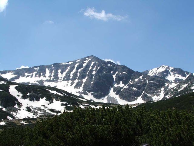
It's name is derived from the name from Slavic mithology (supreme deity was called Perun) - Prenj is a mountain range in the Dinaric Alps of southern Bosnia and Herzegovina, located in eastern Herzegovina near Mostar, Jablanica and Konjic. The highest peak is the Zelena glava at 2,115 m (6,939 ft), and there are several other peaks of similar height.
A lot of high peaks over 2000 meters is located right on this mountain. Snow is pretty common on Prenj even in summer days, but in Mart, when this tour happened, Prenj mountain was decorated with snow and ice as some white snow king. Day was clear and beautiful highly suitable for taking the photos. This mountain is often called "Bosnian Himalaya".
Geologically, the Prenj range is part of the Dinaric Alps and formed largely of secondary and tertiary sedimentary rock, mostly Limestone and Dolomite with notable characteristics of a Karst landform. Due to subterranean drainage, Prenj is relatively dry with few water sources, just a few tiny lakes and some smaller streams that source from these mountains: the Bašcica, and the Bijela, tributaries of the Neretva. Notable peaks are Zelena Glava (2115 m.), Otiš (2097 m.), Lupoglav (1950 m.), Herač (2046 m.), Velika Kapa (2007 m.) and Osobac (2030 m.)
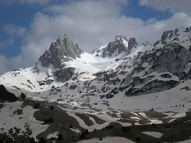 |
| Mountain Prenj: Peaks Zelena glava and Otiš (credits: Wikipedia) |
|
|
Prenj is a very attractive destination for climbers and hikers. The peaks bear typical dolomitic features with vertical rock faces, soaring over green alpine valleys and dense mixed forests. Some mountain huts have re-opened (Bijele Vode, Hrasnica Pl. Kuca) and marked itineraries to the main peaks have been re-established.
Important: if you decide to visit this beautiful mountain, we strongly advice to get a local guide, because contamination with land mines and unexploded ordnance is a serious threat, because of war in Bosnia 1992-1995.
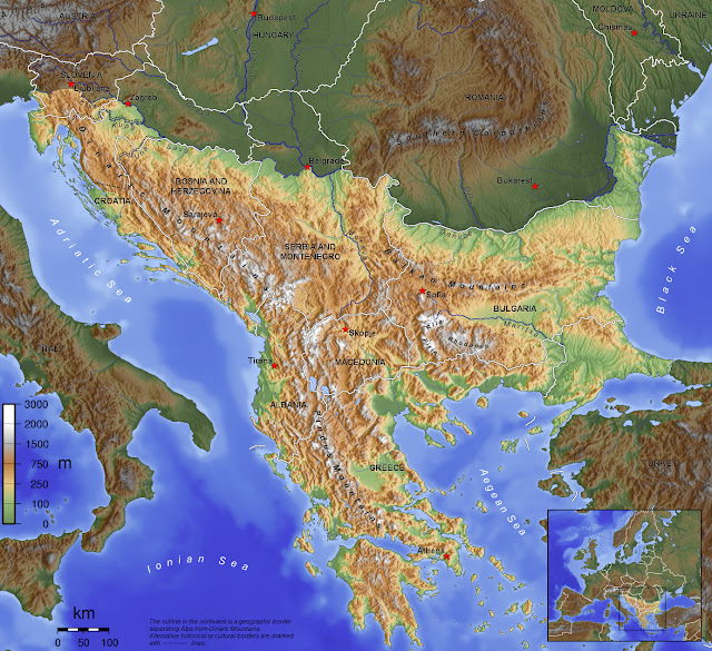
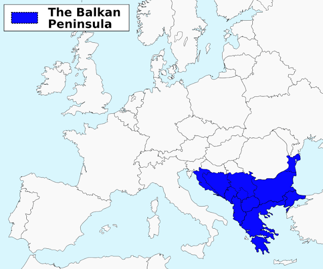
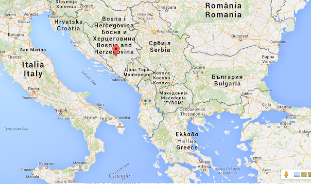 |
| Prenj on a map of Balkans |
Arriving to Prenj
If you are traveling to Prenj, you can do it by car from Sarajevo (60 km) or from Mostar (20 km). Cities Konjic and Jablanica are just below mountain. Climbing to highest peaks is possible from several directions - from Konjic (village Bijela on north side), Boracko leak (village Borci on north-east side), from Jablanica (northwest) and Mostar (south).
In Ice age, this area was under the ice up to 1,500 meters in height with glaciers (glacier Otis - 5-6 kilometers in length, Tisovica 4-5 km, ...), and here you'll find layers of limestone. Prenj is has pretty peaks with winding reef.
Climate
Prenj has a unique and variable mountain climate, which is caused by
warm Mediterranean air masses from the south and cold continental masses
from the north. As a result of this ever-changing climate, snow is even
possible in the summer. Prenj is characterized by alternating bands of
coniferous and deciduous forests, picturesque limestone peaks and some
of the most beautiful vantage points you'll find in BiH.
Climate on Prenj is very skittish and freakish, so the sudden changes in weather are sometimes instant. Distance of sea, reef and height above the sea have strong influence on weather on Prenj. On south sides of mountain we have influence of mediterranean climate.
There are three height zones on mountain Prenj: low (valley), middle (karst) and high (glacial). Those zones are different in term of weather, especially when it comes to temperatures. Mountain summits stops penetration of cold air from north, in same way as the stops penetration of warm air from mediterranean on south. Battle of those two causes often and sudden changes of weather.
Climate depends on height and orientation of mountainside, and with it vegetation. Mountainside on south are exposed to sun much more, so they covered with snow less time and in principle they are warmer then others. But because of that, there is less moisture in ground, which affects plant species. Northern mountainside is opposite and there is greater diversity in vegetation. On east and west, situation is much the same.
Mountain Prenj is hoisting from 120 meters to 2,155 meters above the sea level, so the differences in plants is significant. With every 100 meters in height, temperature drops for about 0.7 Celsius, so the temperature difference between bottom and top of mountain is about 14° C. In the lower area of mountain (up to 1,000 meters) we have deciduous woods (oak, hornbeam, beech and pine). Higher (up to 1,600 meters) is a belt of beech, spruce, pine and Bosnian pine woods. And more higher are low beech and juniper woods. The summits are cold, with snow that stays there for many months during the year, so there are only toughest juniper woods. Alpine meadows are represented on the very top of the mountain and they are full with sesonal flower.
Biological and ecological importance of this are is significant. There are 235 plant communities here (75% of all plant communities in Bosnia and Hezegovina). There are 308 endemic, sub-endemic and relict species of Dinaric area, and 44 species are strongly endemic on mountain Prenj and Čvrsnice (so called stenoendemic).
There is a diversity of animal life too. There can be found mountain goats, bears, deer and elk, wild boars, wolves, foxes, weasels, hares, martens, badgers, and so on. In underground waters above 1,500 meters live triton and variety of endemic alpine triton. Viper snakes can be found on Prenj, even on higher altitudes. Unfortunately, last war in Bosnia left major effect on wild animals and today there is a problem of poaching.

 |
| Old train (from museum) in Jablanica. Behind, you can see summit of Prenj. (credits: 500px) |
|
|


