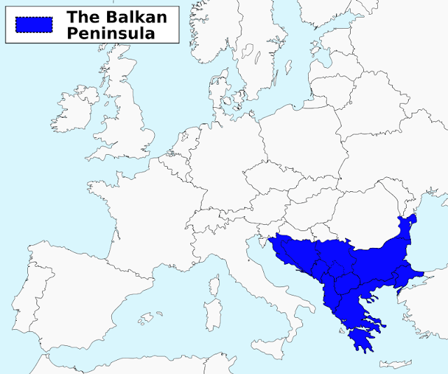
The Balkan peninsula or shorten the Balkans is region on southeast of Europe. The Balkans are usually characterized as comprising Albania, Bosnia and Herzegovina, Bulgaria, Croatia, Kosovo, Macedonia, Montenegro, Romania, Serbia, and Slovenia—with all or part of each of those countries located within the peninsula. Portions of Greece and Turkey are also located within the geographic region generally defined as the Balkan Peninsula, and many descriptions of the Balkans include those countries too. Some define the region in cultural and historical terms and others geographically, though there are even different interpretations among historians and geographers.
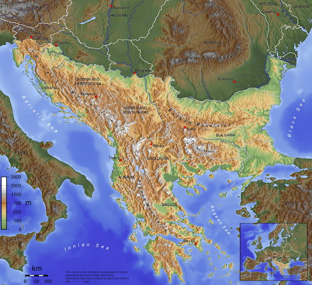
Generally, the Balkans are bordered on north by rivers Kupa, Sava and Danube, on east by Black Sea, on southeast by Aegean Sea, on south by Ionian Sea, and on west by Adriatic Sea.
The total area of the Balkans is 666,700 square km (257,400 square miles) and the population is 59,297,000 (est. 2002). The highest point of the Balkans is Mount Musala 2,925 metres (9,596 ft) on the Rila mountain range in Bulgaria.
 |
| The Balkans (credits: Wikipedia) |
Countries whose territories lie entirely within the Balkan peninsula:
- Albania
- Bosnia and Herzegovina
- Bulgaria
- Greece (mainland)
- Kosovo
- Macedonia
- Montenegro
Countries that lie partially within the Balkan peninsula:
- Croatia (alternatively placed in Central Europe and Southeastern Europe)
- Romania (alternatively placed in Central Europe and Southeastern Europe)
- Turkey (alternatively placed in Southwestern Asia or Southeastern Europe)
- Serbia (alternatively placed in Central Europe and Southeastern Europe)
- Slovenia (alternatively placed in Central Europe and Southeastern Europe)
 |
| The Balkans - political map (credits: Wikipedia) |
As of 1920 until World War II Italy included Istria and some Dalmatian
areas (like Zara, known as Zadar) that are within the general definition
of the Balkan peninsula. The current territory of Italy includes only
the small area around Trieste and Gorizia inside the Balkan Peninsula.
However, the regions of Trieste and Istria are not usually considered
part of the Balkans by Italian geographers, due to a definition of the
Balkans that limits its western border to the Kupa River.
The word Balkan is Turkish and means “mountain”, and the peninsula is
certainly dominated by this type of landform, especially in the west.
The Balkan Mountains lie east-west across Bulgaria, the Rhodope
Mountains extend along the Greek-Bulgarian border, and the Dinaric range
extends down the Adriatic coast to Albania. By some definitions the
region’s northern boundary extends to the Julian Alps and the
Carpathians. Among these ranges extensive areas of good arable land are
relatively scarce, though the valleys of the Danube, Sava, and Vardar
rivers, eastern Bulgaria, parts of the Aegean Sea coast, and especially
the Danubian Plain are exceptions. The mountains have a significant
impact on the climate of the peninsula. The northern and central parts
of the Balkans have a central European climate, characterized by cold
winters, warm summers, and well-distributed rainfall. The southern and
coastal areas, however, have a Mediterranean type of climate, with hot,
dry summers and mild, relatively rainy winters.
Post a Comment